25-Oct-2024 08:45 PM
2855
Kendrapara, Oct 25 (Reporter) The devastation could have been severe if Cyclone Dana had not made landfall in the mangrove-covered Bhitarkanika area under the Rajnagar block, said Sudarshan Gopinath Jadav, Divisional Forest Officer (DFO) of Rajnagar Mangrove Forest and Wildlife Division.
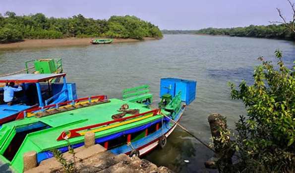
The severe cyclonic storm Dana made landfall on Habalikhati Island, situated within the Gahirmatha Marine Sanctuary of Bhitarkanika National Park.
During its landfall, several forest cottages and the doors and windows of tourist cottages were damaged, and many casuarina trees were uprooted along the sea coast at Habalikhati. Even the branches of several tall mangrove species were damaged, and some mangrove trees were uprooted within Bhitarkanika National Park.
The DFO, however, reported that there was no significant damage caused by Cyclone Dana.
Some sections of the Nasi-2 beach, a favored nesting site for the endangered Olive Ridley sea turtles, experienced erosion due to strong winds and tidal waves from the turbulent sea.
Due to the rough sea conditions, forest personnel could not visit Nasi beach to assess its condition, Jadav stated.
He noted that the mangrove cover helped protect the lives and property from the cyclone's impact. This event has once again demonstrated the vital role that mangrove forests play in shielding areas from natural disasters like cyclones and tsunamis, as they serve as natural barriers against gale-force winds by reducing wind velocity and tidal surges in nearby coastal villages.
Mangrove forests help prevent soil erosion and protect watersheds at river mouths and along coastlines. Their deep-root systems act as barriers against tidal waves and sea currents, while the density and variety of their trees create a buffer zone that mitigates the impact of floods and storm surges. Mangroves are particularly effective during more violent storms.
Greater devastation, including more damaged electric poles and houses, would likely have occurred if the mangrove cover had not acted as a protective wall against the wind, the DFO explained.
Tidal water might have inundated several areas, but thanks to the mangrove forest, the damage was minimized during the landfall, he added.
According to forest officials, the Bhitarkanika mangrove forest, which spans over 213 km and is the second-largest mangrove forest in India after the Sundarbans in West Bengal, is home to 55 of the 58 true mangrove species. However, this vital ecosystem is rapidly disappearing.
Assistant Chief Engineer of Irrigation and Executive Engineer of Aul Saline Embankment, Umesh Chandra Sethy, mentioned that no major inundation occurred in the area due to tidal waves.
He said sandbags were placed along vulnerable embankments at Talachua, Bajarapur, Satagaon, Bagapatia, and Koilipur, which prevented the tidal water from overtopping the embankments.
For the first time during a cyclone, no large areas were inundated with tidal water, stated Sethy, head of the Aul Saline Embankment office...////...